What is a Drone Sensor and How Does It Work in 2026?
In 2026, the world of drone technology has evolved rapidly. Central to this evolution is the "Drone Sensor." This device plays a critical role in enhancing the capabilities of drones. It allows drones to gather data in real-time, making them more effective for various applications.
Drone sensors are designed to detect and respond to changes in their environment. They enable drones to navigate complex terrains and obstacles. The use of advanced technologies such as LiDAR and thermal imaging has improved sensor accuracy. However, the complexity of these systems can sometimes lead to challenges. Sensors must be regularly calibrated to ensure reliability in high-stakes situations.
It's essential to understand the limitations of drone sensors. They can misinterpret data or fail in adverse weather conditions. Therefore, ongoing research and development are crucial. Awareness of these issues allows users to make informed decisions. As we explore the mechanics of drone sensors, it becomes clear that these devices are both powerful and imperfect.
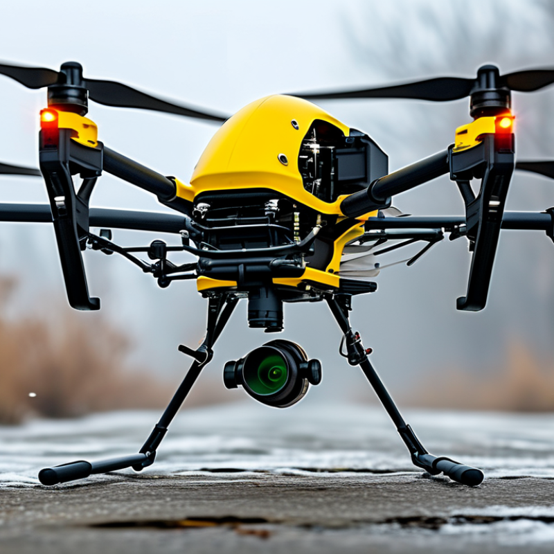
What Defines a Drone Sensor in 2026: Key Specifications and Types
In 2026, drone sensors have evolved significantly, shaping industries like agriculture and surveillance. These sensors are defined by their capabilities—such as imaging, thermal detection, and Lidar. Industry reports indicate that the global market for drone sensors is projected to reach $4.8 billion by 2027, highlighting their increasing importance.
Key specifications include weight, range, and sensitivity. Many modern sensors weigh less than 500 grams, allowing drones to maintain optimal flight dynamics. Alongside this, range varies widely; optical sensors can detect objects over several kilometers, while Lidar systems can generate high-resolution maps with impressive accuracy. Thermal sensors, capable of operating in total darkness, are becoming vital for various applications, from search-and-rescue missions to wildlife monitoring.
As drone technology advances, certain challenges persist. The increasing complexity of sensor integration complicates the design process. Additionally, real-time data processing remains a hurdle, as drones collect vast amounts of data, pushing current bandwidth limits. While advancements are remarkable, industry experts emphasize the need for better data management solutions to fully harness drone sensor capabilities.
The Evolution of Drone Sensor Technology: Major Breakthroughs Since 2020
The evolution of drone sensor technology has seen remarkable progress since 2020. These advancements have transformed how drones gather and analyze data. From basic cameras to sophisticated multispectral and thermal sensors, the capabilities of drone sensors have expanded significantly. They now play a pivotal role in industries such as agriculture, environmental monitoring, and emergency response.
Key breakthroughs include enhanced data processing and communication technologies. This allows drones to operate more autonomously and share information in real time. As sensors become smaller and more powerful, their applications continue to grow. For instance, lidar technology is now being integrated, enabling detailed terrain mapping and vegetation analysis. Yet, challenges persist. Issues surrounding data privacy and sensor calibration remain important areas for improvement. Companies must address these to maintain public trust and ensure effective sensor deployment.
Emerging fields like artificial intelligence are now merging with drone sensor technology. AI enhances the capability of drones, allowing them to interpret data quickly. This combination leads to faster decision-making processes in critical situations. However, it raises questions about the reliability of AI-driven decisions. Continuous testing and evaluation are necessary to refine these systems. The evolution of drone sensors is fascinating, but the journey is ongoing. Each step forward presents both opportunities and challenges in this rapidly changing landscape.
How Drone Sensors Function: The Science Behind Data Collection
In 2026, drone sensors play a crucial role in data collection and analysis. These sensors gather various types of information, such as temperature, humidity, and atmospheric pressure. Advanced sensors can capture high-resolution images and videos. Equipped with multi-spectral sensors, drones can also detect subtle changes in crop health. This data helps farmers make informed decisions.
The functioning of drone sensors relies on the integration of technology and scientific principles. Sensors convert physical phenomena into signals that can be analyzed. For instance, optical sensors use light waves to capture detailed images. The data is then transmitted to ground stations for processing. However, challenges remain. Signal interference and environmental factors can affect data accuracy.
While many advancements have been made, imperfections persist. Sensor calibration is vital for reliable readings. Regular maintenance helps to ensure consistent performance. Users must remain vigilant, as not all collected data is flawless. Trusting sensor data without verification can lead to misguided decisions. Continued research is essential in addressing these limitations.
What is a Drone Sensor and How Does It Work in 2026? - How Drone Sensors Function: The Science Behind Data Collection
| Sensor Type | Description | Primary Use Case | Data Output Type | Operating Range |
| RGB Camera | Captures high-resolution images and videos in visible light. | Aerial photography, mapping, surveillance. | JPEG, RAW images, video streams. | Up to 5 kilometers. |
| Thermal Sensor | Detects radiation in the infrared spectrum to visualize temperature variations. | Search and rescue, building inspections, wildlife monitoring. | Thermal images, temperature data. | Up to 3 kilometers. |
| LiDAR Sensor | Uses laser light to measure distances and create 3D models of the environment. | Topographic mapping, forestry analysis, urban planning. | Point clouds, digital elevation models. | Up to 1 kilometer. |
| Multispectral Sensor | Captures data across different wavelengths of light for various applications. | Agricultural analysis, environmental monitoring. | Reflectance data in multiple bands. | Up to 4 kilometers. |
| Ultrasonic Sensor | Uses sound waves to measure distances accurately. | Obstacle avoidance, distance measurement. | Distance data in meters. | Up to 10 meters. |
Applications of Drone Sensors in 2026: Industries Revolutionized
In 2026, drone sensors have transformed various industries. These sensors enable precision agriculture, environmental monitoring, and infrastructure inspections. For example, in agriculture, drones equipped with multispectral sensors are crucial for crop health analysis. Reports indicate a 20% increase in yield through data-driven decisions.
Construction and infrastructure sectors benefit immensely from drone technology. Sensors provide real-time data for project management. According to the Drone Industry Insights report, over 50% of construction companies have adopted drones for site monitoring. This not only accelerates progress but also improves safety by minimizing human error.
However, challenges remain. Data security is a significant concern. With increased sensor use, vulnerabilities arise in data transmission and storage. Moreover, regulatory frameworks struggle to keep pace with rapid advancements. Continuous improvement in sensor technology must focus on security measures to ensure trust and reliability. Balancing innovation with safety and privacy will be essential for future growth.
Future Trends: Anticipated Developments in Drone Sensor Technology
In 2026, drone sensor technology is poised for remarkable advancements. Industry reports suggest that the global drone sensor market is expected to grow significantly, reaching over $4 billion by 2026. This growth is driven by increasing demand for high-resolution imaging and real-time data collection. A major trend involves the integration of LiDAR technology, which allows drones to create detailed 3D maps. This capability is essential for industries like agriculture and construction, where precise measurements are crucial.
Another anticipated development is the enhancement of multispectral and hyperspectral sensors. These sensors can capture data across various wavelengths, enabling more accurate environmental monitoring. According to a recent survey, around 70% of drone operators believe that improved sensor capabilities will enhance workflow efficiency. However, challenges remain. Ensuring data accuracy and integrating machine learning for better data interpretation are ongoing hurdles. Addressing these issues is vital for the broader acceptance of drone technology in commercial applications.
With the rising complexity of drone sensors, training for operators is becoming increasingly important. Reports indicate that about 60% of drone pilots feel underprepared to utilize advanced sensor technologies fully. Bridging this skills gap is necessary to leverage the full potential of drone sensors. The future is promising, yet there is much work to be done to ensure that the technology can be utilized effectively and responsibly.